Lewis Wharf, Boston's Gateway to Joshua Norton's New World
The Granite Market Building on the Boston Wharf Where Joshua’s Ship from Liverpool Landed in 1846 Probably Was the First Structure He Laid Eyes on When He Set Foot on Dry Land. It’s Still Standing.
JOSHUA NORTON was aboard the Medford, Massachusetts-built packet ship Sunbeam when the ship arrived in Boston from Liverpool on 12 March 1846.
The Sunbeam had departed Liverpool on February 10th — meaning that Joshua probably would need to have left Cape Town no later than November 1845 in order to make the whistle.
Packet ships like the Sunbeam carried the gamut of “cargo” — passengers, mail, freight.
It’s the freight, the market-bound goods, that give us the first clue to where — or, rather, at which of Boston’s many wharves — the Sunbeam landed.
On 14 March 1846 — two days after the Sunbeam’s arrival — the Boston Courier and other Boston papers ran the following notice that the Sunbeam would “commence discharging” its freight the following Wednesday at Lewis Wharf:
Notice of freight unloading date for the packet ship Sunbeam, which arrived at Lewis Wharf, Boston, on 12 March 1846, Boston Semi-Weekly Advertiser, 14 March 1846, p.2. Source: Genealogy Bank
Enoch Train & Co. was the packet line that ran the Sunbeam — and that may also have owned the ship. The company’s offices were at Lewis Wharf. The following ad that appeared on 14 March 1846 suggests that Enoch Train & Co. had a piece of the commodities action, too:

Ad for Liverpool salt from the freight of the packet ship Sunbeam, which arrived at Lewis Wharf, Boston, on 12 March 1846, Boston Semi-Weekly Atlas, 14 March 1846, p. 3. Source: Genealogy Bank
So, where, exactly, was this Lewis Wharf, where Joshua Norton made his first “footfall” in the United States of which he would declare himself Emperor 13 years later?
Here’s an 1846 map of Boston. “North” is oriented to the right.
A New & Complete Map of the City of Boston, with part of Charlestown, Cambridge & Roxbury, by George W, Boynton, 1846. Published by N. Dearborn. Collection of the Boston Public Library. Source: Leventhal Map & Education Center
In the following detail of this map, Lewis Wharf is visible as one of the larger wharves at top right:

Zooming in closer still: The two largest wharves, adjacent to one another near the center of the detail, are Central Wharf and Long Wharf. Casting your eyes to the right (north), the first large wharf you see is Commercial Wharf. Lewis Wharf is next.

:: :: ::
PROBABLY the first building Joshua Norton laid eyes on as he disembarked from the Sunbeam onto Lewis Wharf was the long 4-plus-story warehouse that anchored the wharf.
An impressive edifice of timber and local Quincy granite, the warehouse — constructed in 1836 — was built and owned by the aptly named Lewis Wharf Company. The architect was Richard Bond (1798–1861).
The warehouse had a gable roof — and its western end fronted on Commercial Street, by geographical definition the first street that Joshua Norton walked on in the United States. Those who know of Emperor Norton’s long association with San Francisco’s Commercial Street — where the Emperor lived from 1864/65 until his death in 1880 — will appreciate the symmetry.
Although the Lewis Wharf building served primarily as a warehouse, the Lewis Wharf Company put customer-facing stores at the bottom (wharf level) of the building. In doing this, the company was following the practice of the wharf’s namesake, Thomas Lewis (1750–1813), a prosperous merchant who owned the wharf by the 1780s and who — in addition to having warehouses here — had his own store and also leased space to many other merchants, an innovation that turned the wharf into a kind of early shopping mall.
Granite waterfront market buildings like the one built by the Lewis Wharf Company were the New England state of the art in the 1830s — and the Lewis Wharf building was regarded as a fine example of the typology.
An early view of Lewis Wharf is in an engraving of the panorama of the Boston waterfront looking west from East Boston, Mass, — not far from the current site of Boston Logan Airport. The engraving — done in 1848, just two years after Joshua Norton’s arrival — is by Edwin Whitefield (1816–1892).
The Lewis Wharf building is visible by looking down and to the left of the domed Massachusetts statehouse — and directly above the paddle steamer Governor:
View of Boston in 1848 from East Boston, engraving by Edwin Whitefield (1816–1892), with detail below. Image is of a print produced in 1899. Collection of the Boston Public Library. Source: Digital Commonwealth
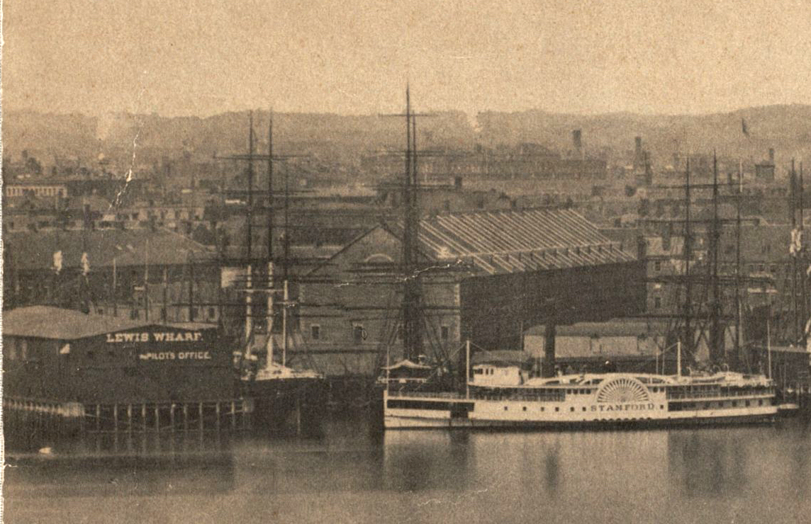
Possibly the earliest clear photographic capture of the gabled Lewis Wharf market building is in the center panel of a 5-panel panorama taken c.1877. The building is visible on the left (south) side of the panel, shown below. Once again, the view is to the west from East Boston.
The building is “between” and immediately to the west of the Lewis Wharf pilot’s building and the ferryboat Stamford. Click to enlarge — and see the caption for a link to the full panorama.
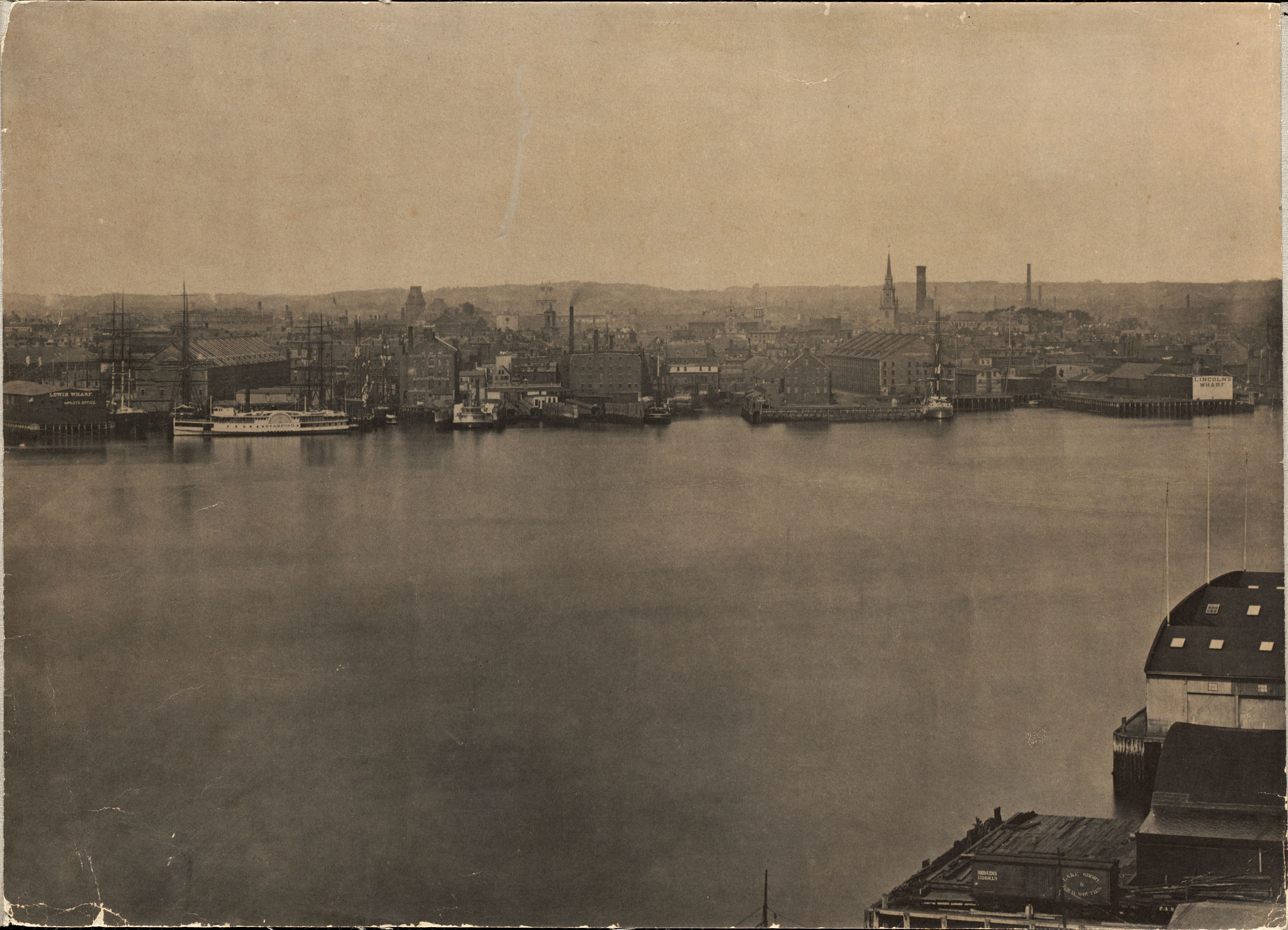
The Lewis Wharf market building, at left, is the large gabled structure visible between the Lewis Wharf pilot’s office and the ferryboat Stamford. Center panel of a 5-panel panorama of the Boston waterfront from East Boston, c.1877. For the full panorama, click here. Collection of the Boston Public Library. Source: Digital Commonwealth
Here’s a closer view of the building, brightened a little to show details.
In pre-1970s photographs of this section (North End) of the Boston waterfront, the distinctive exposed “rib” supports visible on the gable roof are a good way to pick the Lewis Wharf building out of “the crowd.”
By the time this panorama was taken in c.1877, the Lewis Wharf market building was some 20–25 percent shorter than when Joshua Norton saw it in 1846. Looking to expand this section of the waterfront, the City of Boston between 1868 and 1874 built a new road, Atlantic Avenue, to the east of wharf-adjacent Commercial Street — with Atlantic Avenue cutting a path through eight wharves, including Lewis Wharf, whose granite market building was partially demolished in June 1870 to make way for the new development.
Worth noting…
A block or so to the west (“inland”) of Lewis Wharf — at the northeast corner of Lewis and Ann (now North) Streets — stood the King’s Head Tavern, which had stood on that spot since 1660, its original exterior walls serving as the last standing relics after the tavern was rebuilt following a fire that destroyed the tavern’s interior in 1691.
As part of the urban reconfiguration of 1868–74, this building was demolished and a new building constructed — in 1874 — that housed stores that had been displaced by the partial demolition of the Lewis Wharf building.
The 1874 building still stands. But, here’s a great photo of the lost King’s Head Tavern, taken c.1868 — just two years before it was demolished.
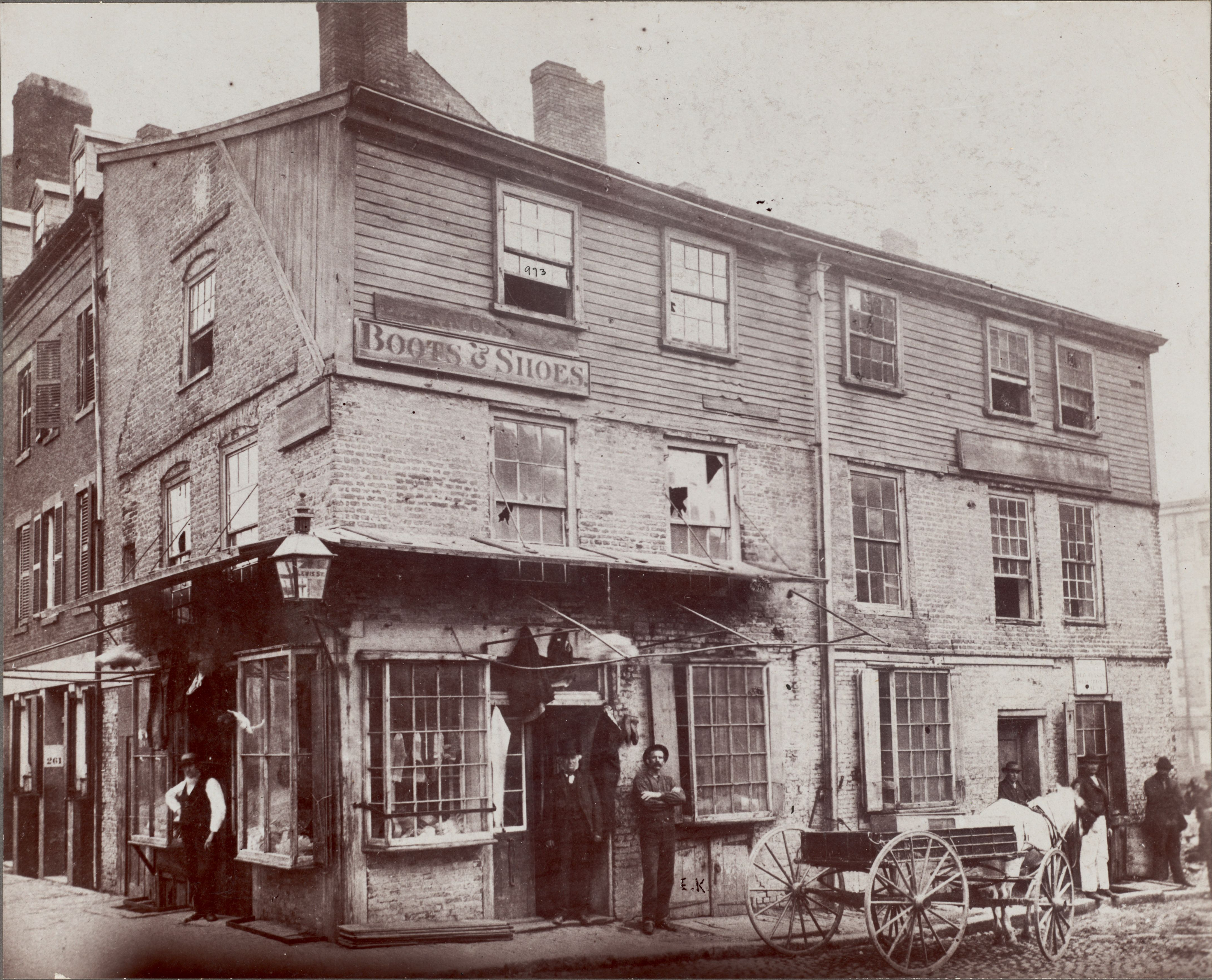
King’s Head Tavern, northeast corner of Lewis and Ann (now North) Streets, Boston, c.1868. Built 1660; rebuilt after fire, 1691; demolished 1870. Collection of the Boston Public Library. Source: Digital Commonwealth
:: :: ::
IT APPEARS THAT the Lewis Wharf market building remained substantially unchanged through the early years of the twentieth century.
Here’s a harborside peek from 1884. The market building is on the left.

Lewis Wharf building (left) facing the harbor, Boston, 1884. Source: Historic New England
Here’s the Atlantic Avenue end of the building twenty years later, around 1904. The irregular shape and configuration of the Atlantic frontage of the building relative to the first vertical ribbed gable support suggests that the street-facing mansard roof treatment at the 5th-floor level was an artifact of the 1870 “cut.” This may have become a design inspiration for how the building was modified decades later.
Lewis Wharf building fronting Atlantic Avenue, Boston, c.1904. Collection of the Boston Public Library. Source: North End Waterfront
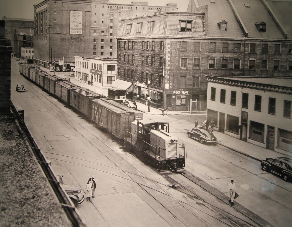
The following aerial photograph of the North End waterfront of Boston was taken c.1918–1925. Lewis Wharf is the shorter of the two wharves at the center of the photo. We see here that, by the second decade of the twentieth century, individual owners within the Lewis Wharf market building had built their spaces up and out above the fourth floor, with the higgledy-piggledy result that the original gabled roofline was vanishing.
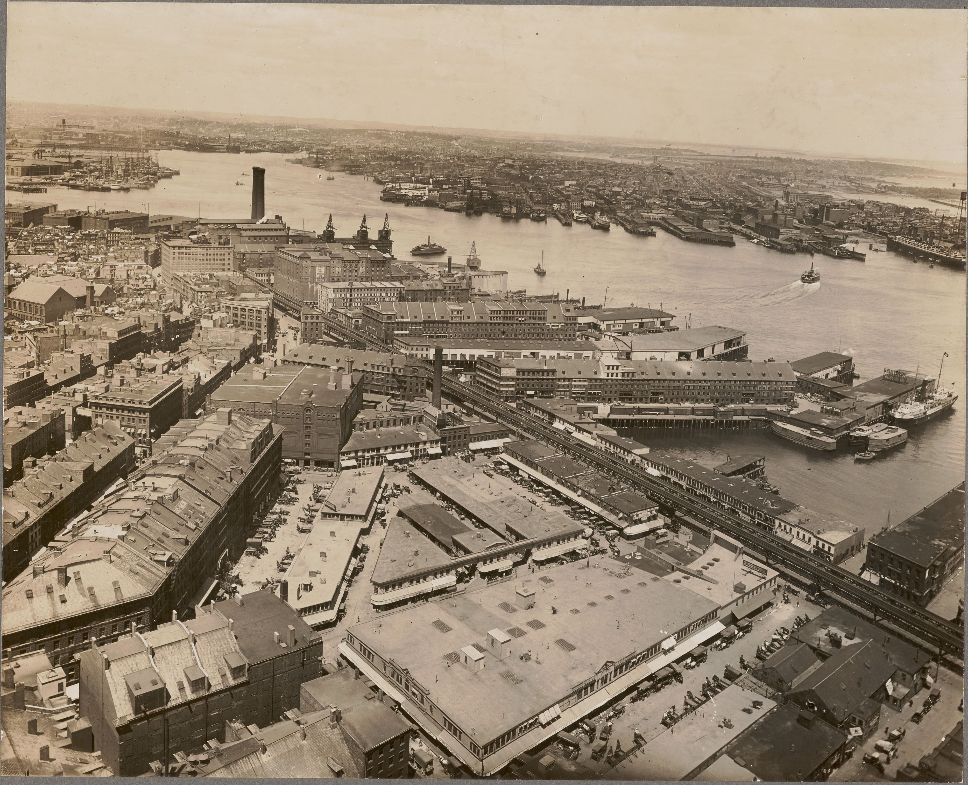
Aerial of Boston’s North End waterfront, c.1918–1925. Photograph by Leon H. Abdalian (1884–1967), Collection of the Boston Public Library. Source: Digital Commonwealth
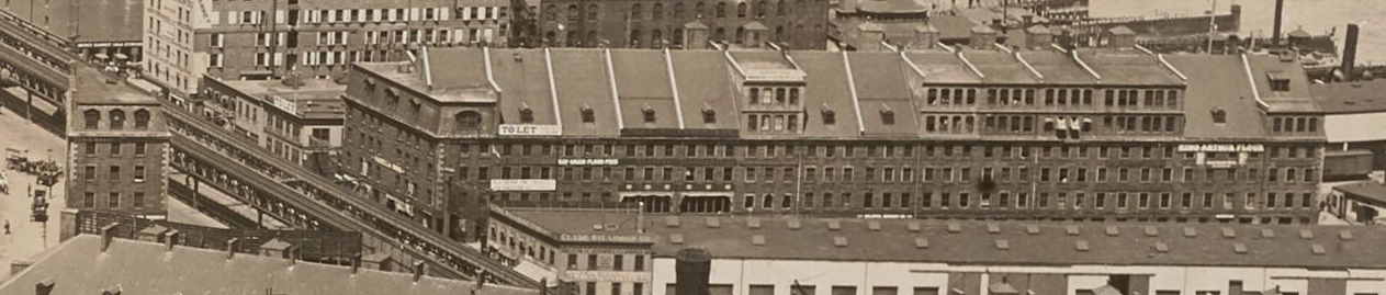
In the following detail of the photograph above, focusing on the Lewis Wharf building, the irregular Atlantic Avenue frontage relative to the original gable roof is even more apparent than in the photo from c.1904.
For a different perspective, here’s an aerial view of Long Wharf (left), Commercial Wharf (center) and Lewis Wharf (right) taken c.1955–64. There has been a little more build-out at the harbor end of the Lewis Wharf building.
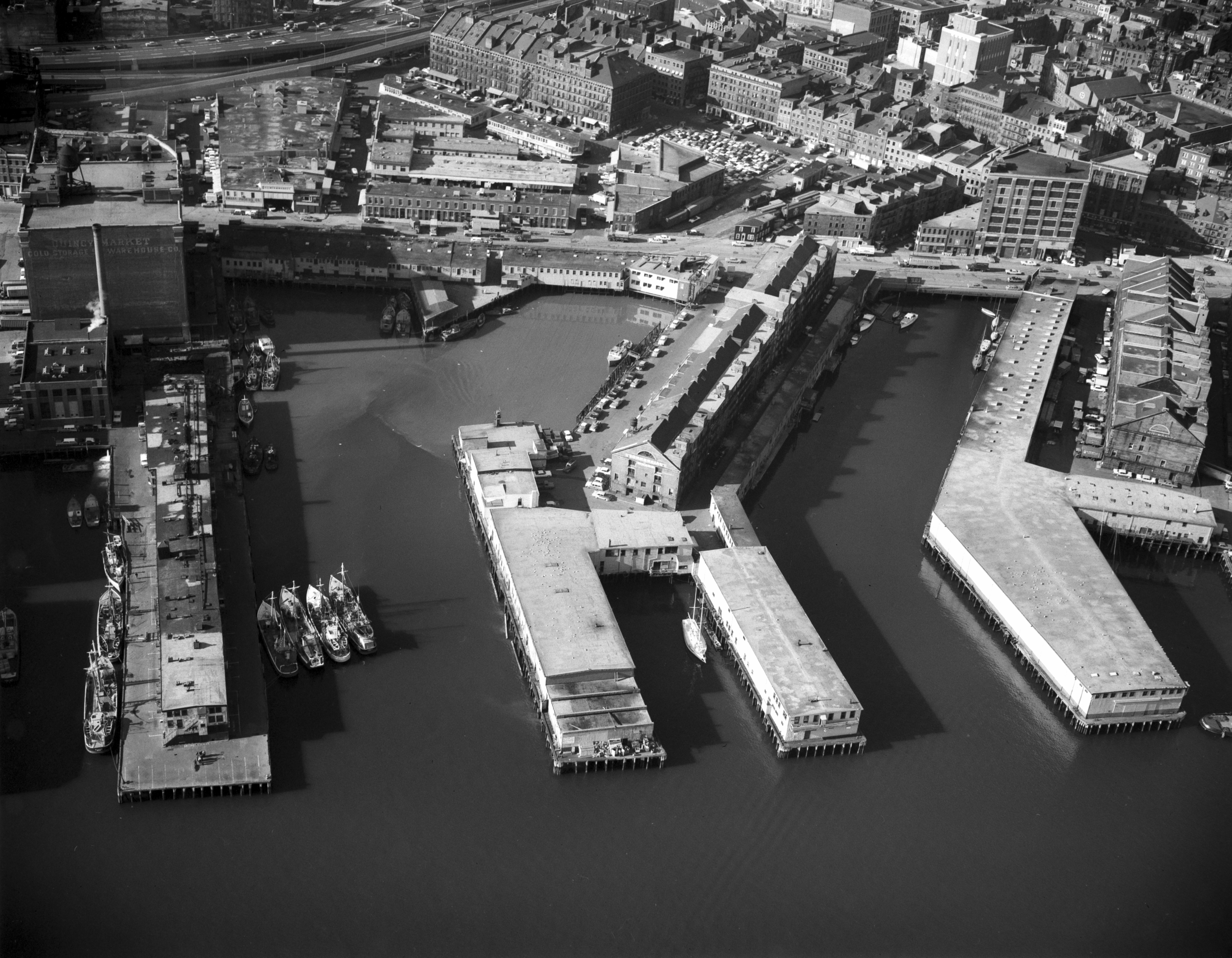
Aerial of Boston waterfront showing (left to right) Long Wharf, Commercial Wharf and Lewis Wharf, c. 1955–64. Source: Northeastern University Library
Of course, the upper floors of many (all?) if these large old masonry wharf buildings were built out over time. And, they were built out without particular regard for aesthetic consequences. After all, wharf buildings were industrial buildings — buildings valued more for what they could do than for how they looked.
But, the photographic record of the Lewis Wharf building in the first half of the twentieth century suggests that “upward growth” did not come about in response to a cohesive strategic plan from the owners of the building. If this were so, we might expect to have seen a full floor or two added to the entire building — or to one side of it — all at once.
Instead, the additions during this period appear to reflect a piecemeal ethos in which — within certain limits — owners of individual businesses within the building were allowed to build out their spaces whenever they wished, according to their needs. Unless the 5th- and 6th-floor additions, most completed by the 1920s, were built by the same business, the general uniformity of the additions does suggest that the owners of the wharf building might have instituted a basic design standard for any such new construction.
We might well be inclined, in 2023, to call a beautifully restored granite building — even a granite warehouse building — from the 1830s “beautiful.” But, wharf building owners probably would not have been overly concerned about aesthetic considerations such as symmetry of form or uniformity and consistency of materials and workmanship.
:: :: ::
IN 1973, the Lewis Wharf building was converted to residential, with retail and offices on the bottom two floors and condominiums on the top four.
Possibly taking his cue from the mansard frontage visible in the c.1904 photograph above, the architect, Carl Koch (1912–1998), chose what may have been the best and only path to restoring aesthetic order to the roof and aesthetic harmony to the building as a whole, while also preserving a starring role for the original granite: mansardify the entire top two floors.
Here’s the result, as the building stands on Lewis Wharf today:
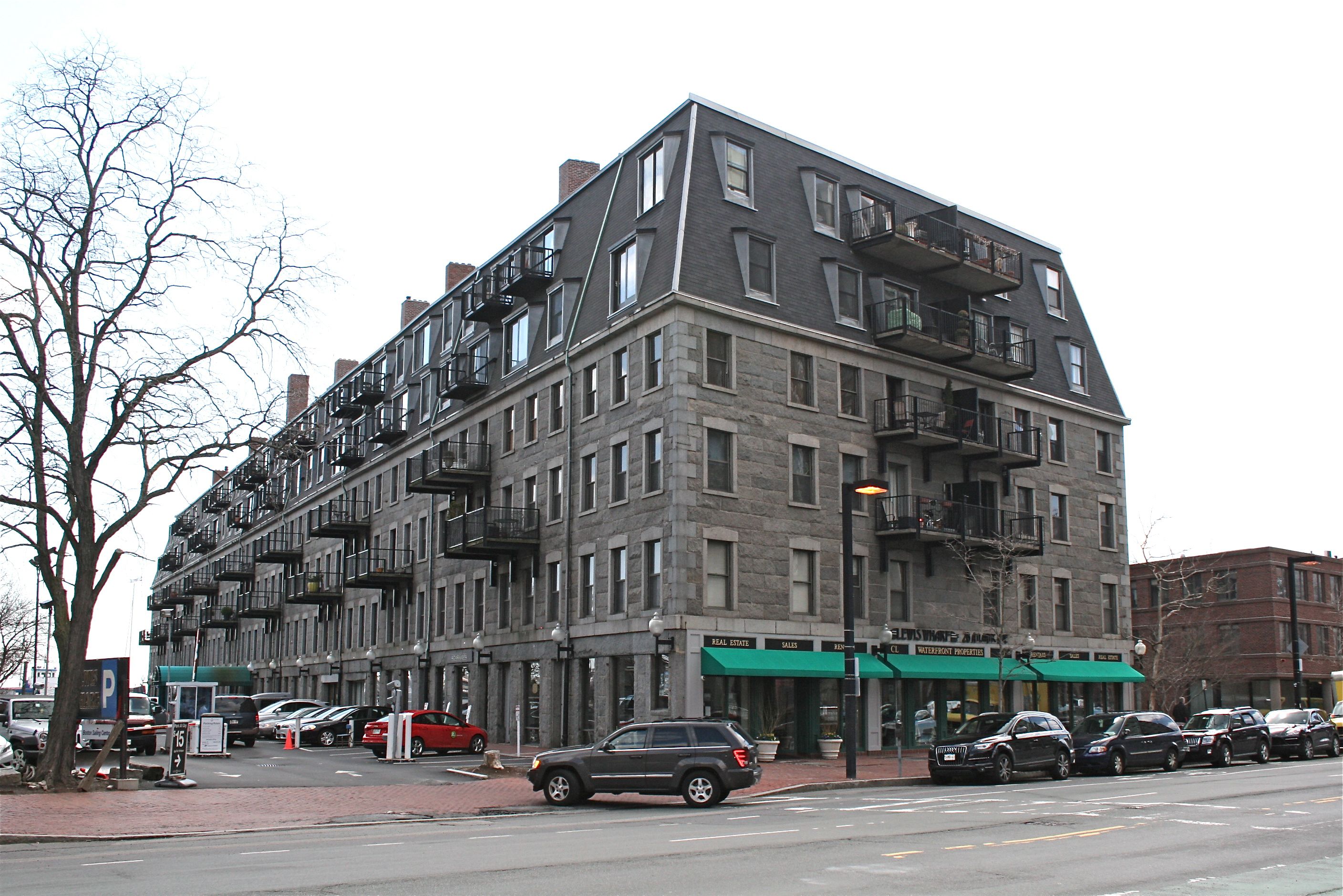
The Lewis Wharf building today. Source: Massachusetts Historical Commission / MACRIS
In the following current satellite view, the 1870 cut is evidenced by the fact that the building’s two “end” perimeters are not parallel — relative to the harbor side of the building, the Atlantic Avenue side is an angular slice the follows the “new” street line.
The first street to the west of Atlantic is the older Commercial Street. Knowing that the building originally extended to Commercial, one can get a sense from this view of how long the building and wharf were when Joshua Norton saw them in 1846.
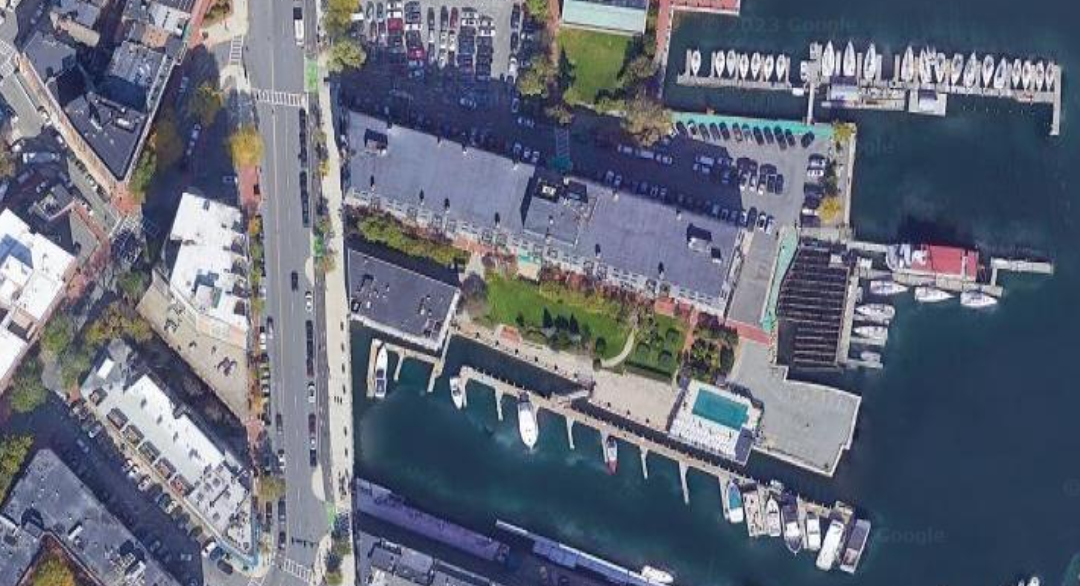
Google satellite view of Lewis Wharf, Boston, and environs, 2023. Source: Google
:: :: ::
A Revolutionary coda…
The wharf that became known as Lewis Wharf in the mid 1830s was created from what previously had been two wharves.
In early maps of Boston, a “Hancock’s Wharf” — previously known as “Clarke’s Wharf” — shows up in this section of the waterfront by 1775.
But, as early as 1795, a plan for the Town of Boston drawn up by Osgood Carleton (1742–1816) shows Hancock’s Wharf adjacent to “Lewis’s Wharf.” Here’s the relevant detail:
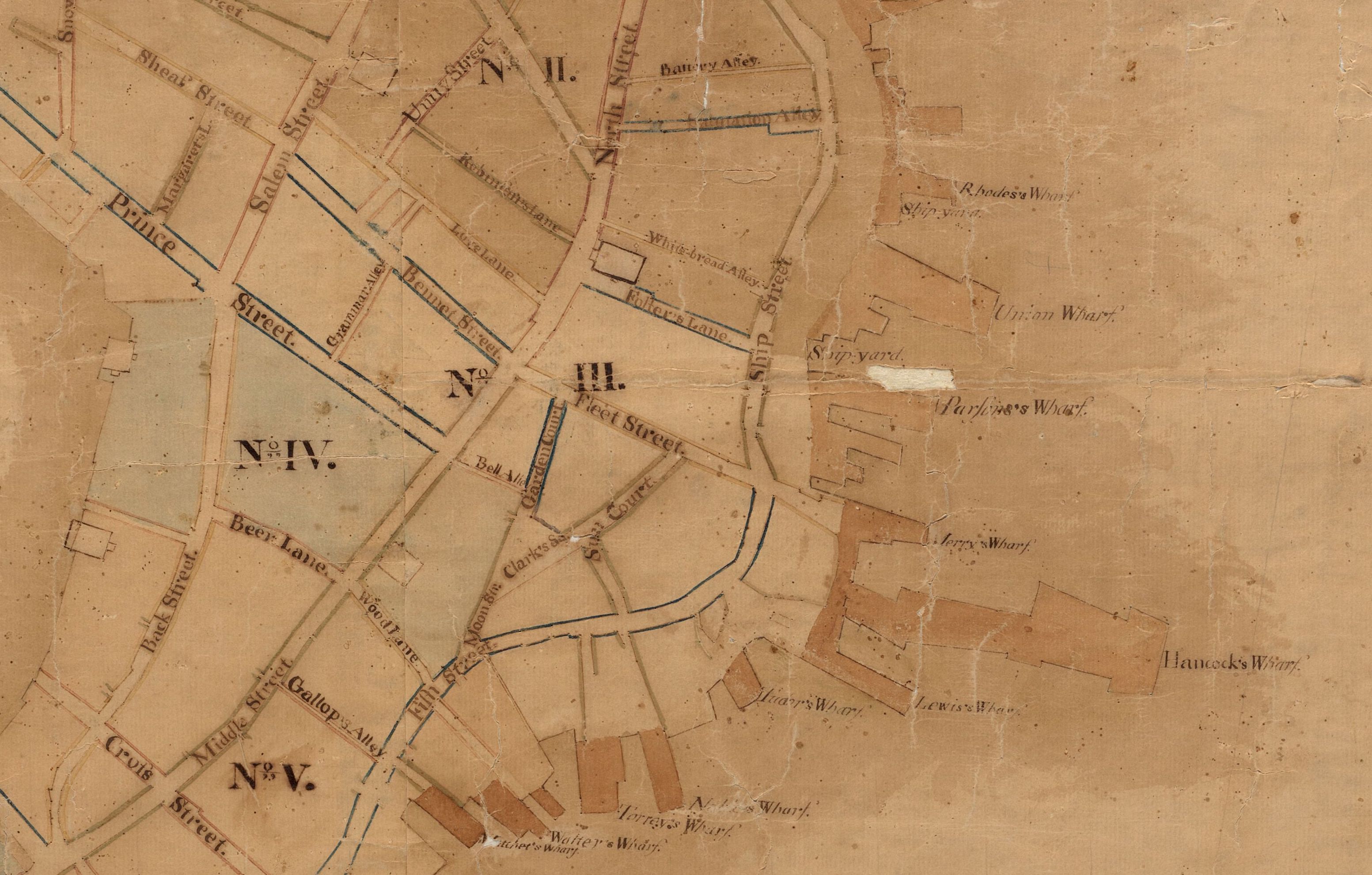
Detail from plan for the Town of Boston, 1795, by Osgood Carleton (1742–1816). Collection of the Boston Public Library. Source: Leventhal Map & Education Center
Plans and maps of Boston continued to show the two wharves, Hancock and Lewis, side by side through 1837. One prominently circulated example was engraved by Hazen Morse (1790–1874) in 1828 and published continuously by Charles Stimpson, Jr. (1793–1869) from 1828 through 1837. Stimpson included a monochrome iteration of the plan in his annual Boston Directory and also published the plan as a separate beautifully colored piece in a leather folder. The plan featured this detail:

Detail from plan for the City of Boston engraved by Hazen Morse (1790–1874) in 1828 and published by Charles Stimpson, Jr. (1793–1869) from 1828 through 1837. Seen here is the monochrome iteration of the plan that Stimpson included in the 1835 edition of his annual Boston Directory. Collection of the Boston Public Library. Source: Leventhal Map & Education Center
Based on the plan of 1795 and newspaper accounts of subsequent decades, it’s clear that the Lewis family had been associated with the wharf that bore its name for some 30 years by 1835.
But, it wasn’t until 25 March 1834 that the Massachusetts legislature passed the Act establishing the Lewis Wharf Company. In part, the Act gave the new Lewis Wharf Company control over both Lewis Wharf and Hancock Wharf. (It appears that the founding treasurer of the company, Samuel Shaw Lewis (1798–1869), was Thomas Lewis’s nephew.)
In 1832, the separate proprietors of these wharves had secured legal permission to extend and enlarge the wharves.
All of these moves could be seen as laying the groundwork for the two wharves to be consolidated into one much larger wharf — so as to create the most suitable platform for the granite market building that the Lewis Wharf Company wanted to, and did, build in 1836.
The consolidation of the two wharves, with “Hancock” jettisoned and the whole thing named “Lewis Wharf” is reflected in the following detail from the 1838 map of Boston by Hazen Morse and Joseph Warren Tuttle (1814–1885) — doing business as “Morse & Tuttle.”
Charles Stimpson published this map, too — the map replacing Morse’s map of 1828.
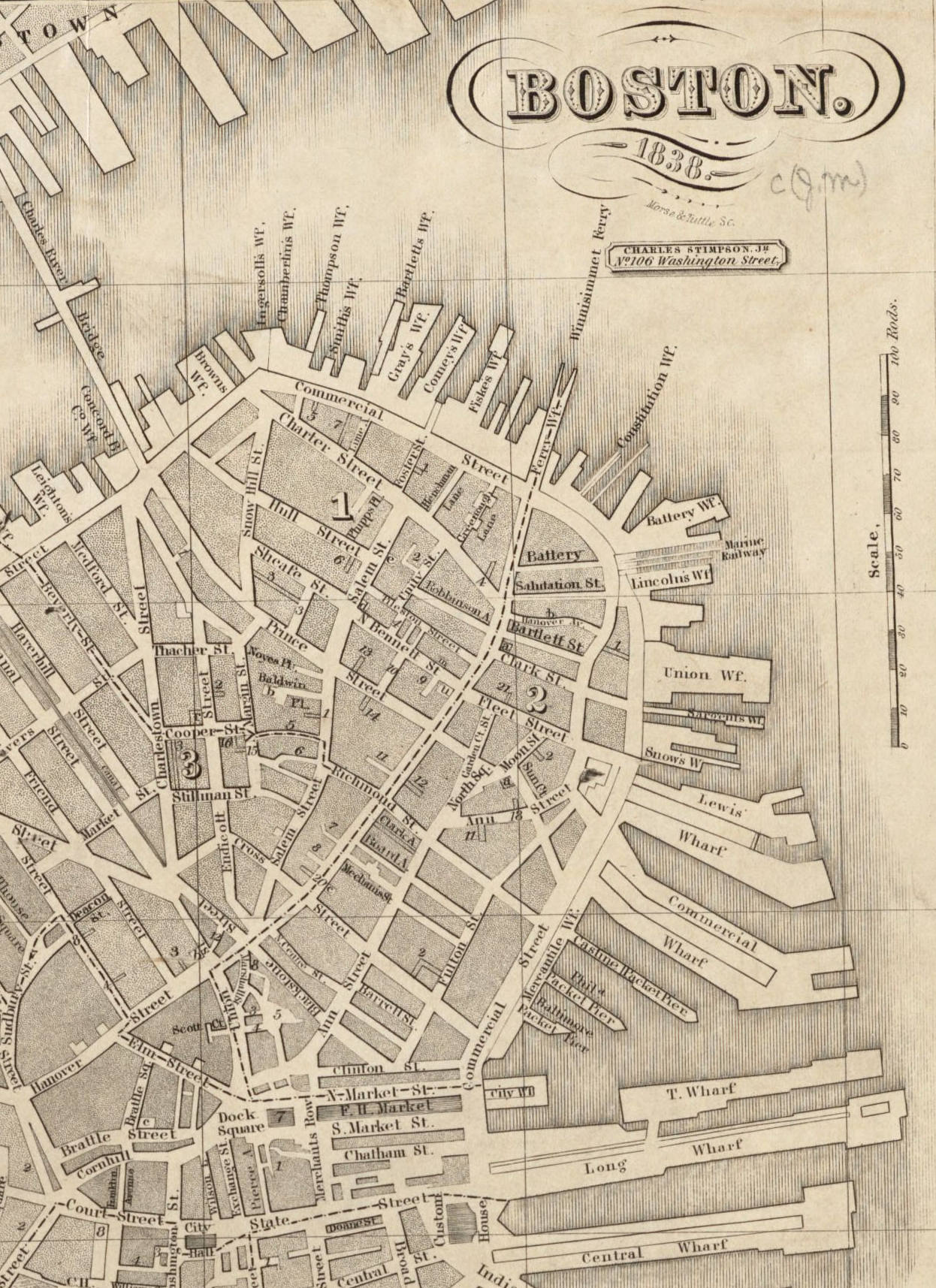
Detail of map of Boston, 1838, by Morse & Tuttle. Hazen Morse (1790–1874) and Joseph Warren Tuttle (1814–1885) were in partnership 1837–1846. Seen here is the monochrome iteration of the plan that Charles Stimpson, Jr. (1793–1869) included in the 1838 edition of his annual Boston Directory. Collection of the Boston Public Library. Source: Leventhal Map & Education Center
As you might have guessed by now, the “Hancock” of Hancock’s Wharf wasn’t just any Hancock but indeed was the family of John Hancock (1737–1793), the legendary figure of the American Revolution, the Declaration of Independence and the birth of the United States.
In fact, the namesake of the wharf was John Hancock’s very wealthy and influential uncle, Thomas Hancock (1703–1764). Shortly after John’s father — a librarian and minister also named John Hancock — died in 1744, when John was 7, Thomas adopted John and spent the next decade-plus grooming John into the Harvard-educated merchant-prince who was perfectly positioned for the Revolutionary moment of the 1770s and beyond. (Thornton Calef Lockwood’s brief but comprehensive, thorough and illuminating 2008 biographical article on John Hancock here is helpful in locating Hancock within this period of Boston’s commercial history.)
When Thomas died in 1764, John inherited the business enterprise known as the House of Hancock — including the wharf. Although maps of Boston don’t recognize this wharf as “Hancock’s Wharf” until 1775, the following newspaper advertisement from 1772 leaves no doubt who owned the wharf:
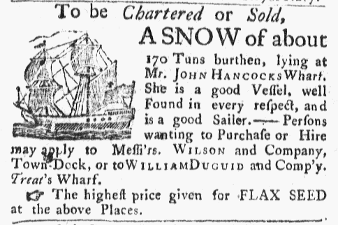
Ad for vessel “lying at Mr. John Hancock’s Wharf,” Massachusetts Gazette, 7 December 1772, p. 4. Source: Genealogy Bank
And, although maps of Boston don’t recognize “Lewis’s Wharf” until 1795, the following 1789 newspaper ad describing “Mr. Lewis’ wharf, first south of Gov. Hancock’s wharf” — John Hancock served his second stint as Governor of Massachusetts between 1787 and his death in 1793 — tells us that the wharves of Thomas Lewis and John Hancock were doing business cheek-by-jowl by the 1780s.
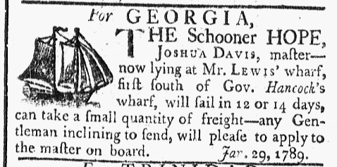
Ad referencing schooner “lying at Mr. Lewis’ wharf, first south of Gov. Hancock’s wharf,” Massachusetts Centinel [spelling as published], 21 January 1789, p. 3. Source: Genealogy Bank
For reference: Exactly two weeks after this ad was published on 21 January 1789, the first Electoral College convened under the recently ratified new U.S. Constitution. The date was 4 February 1789 — exactly 29 years before Joshua Norton was born on 4 February 1818. A month later, on 4 March 1789, the two new houses of Congress convened for the first time.
How much of this relatively recent history did Joshua Norton know when he set his first foot on Lewis Wharf and cast his eyes on the wharf’s impressive granite market building on 12 March 1846?
How much did this history and the vision behind it inspire Joshua’s own vision of what he wanted to do next?
:: :: ::
This article builds on — and is a follow-up to — our previous article, from May 2021: “Joshua Norton First Set Foot in the United States in Boston — in 1846.” This earlier article includes many details about Joshua Norton’s voyage from Cape Town to Liverpool to Boston in late 1845 and early 1846. You can read it here.
:: :: ::
For an archive of all of the Trust’s blog posts and a complete listing of search tags, please click here.
Search our blog...